
Drone services company offering high-quality aerial photography and video to all industries.
Drone services company offering high-quality aerial photography and video to all industries.
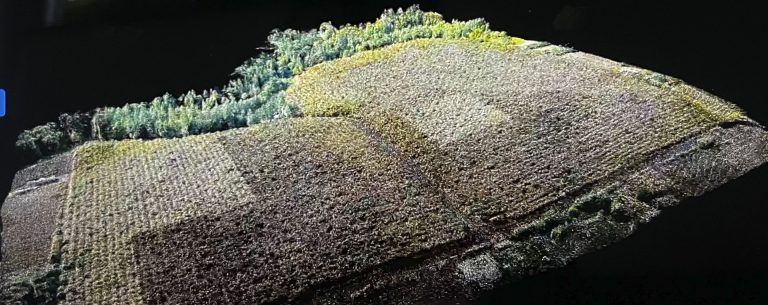
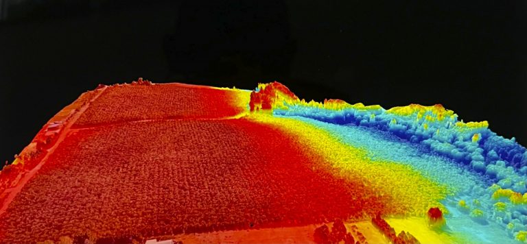
Using aerial and ground-based drones throughout a crop cycle can provide orthomosaic 3D maps for soil analysis, providing data for irrigation and nitrogen-level management. Drones are also used for crop monitoring by showing precise crop development, including any inefficiencies, which results in better crop management. Drones are also used for monitoring irrigation. Our drones, equipped with high-tech sensors, can identify which parts of a field are dry or need improvements. Drones also allow the calculation of the vegetation index, showing the density and health of a crop, and the heat signature, showing the amount of energy or heat the crop emits. Finally, by scanning a crop, using visible and infrared light, we can produce multispectral digital terrain model images that track plant changes that indicate their health. This makes the use of drones for crop management an essential agricultural tool.